Log in
All resources
Create a design
5,876 Free Artworks of Image Map
maps in the library of congress
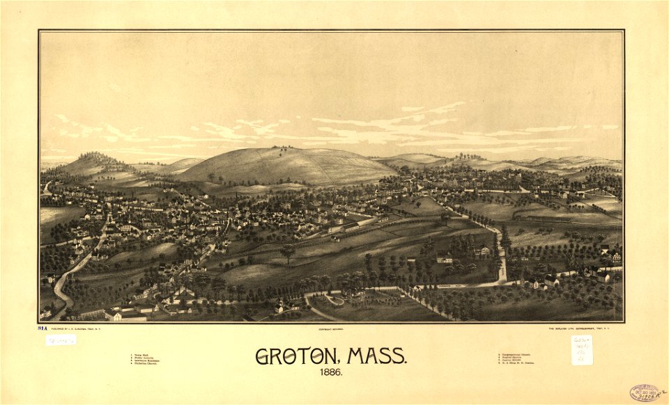
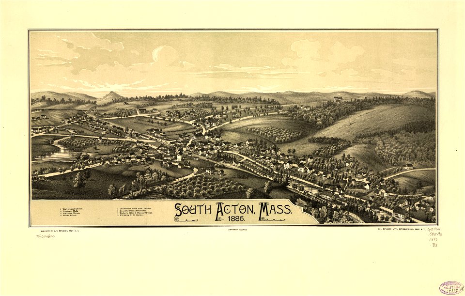
town maps by l. r. burleigh
l. r. burleigh
bird's eye view maps of massachusetts
images of places from encyclopædia britannica
emery walker
maps from encyclopædia britannica
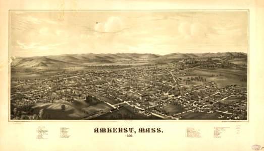
1886 maps of massachusetts
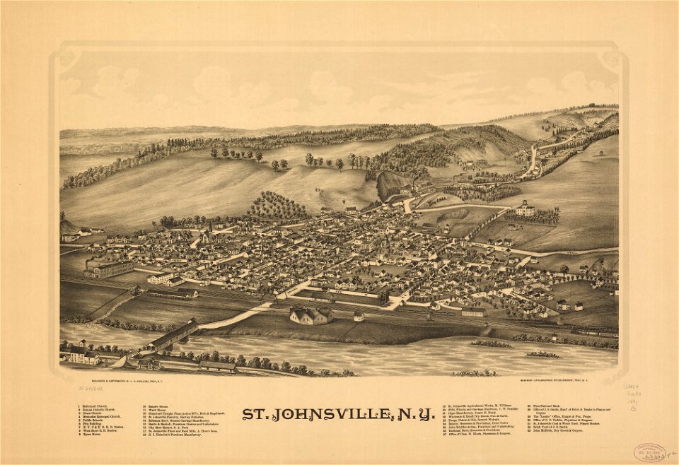
bird's eye view maps of new york (state)
maps by willem and johannes blaeu
historical images of the hôtel d'angoulême lamoignon
turgot map of paris – derivative files
historical images of the moscow kremlin
17th-century maps of moscow
maps in the library of congress
1889 maps of michigan
images of places from encyclopædia britannica
old maps of edinburgh
maps from the earth and its inhabitants, vol. iv
maps of river trent
images of places from encyclopædia britannica
old maps of manchester and salford
historical images of somalia
fra mauro map details
william hole (engraver)
michael drayton
fra mauro map
maps in the library of congress
18th-century maps of martinique
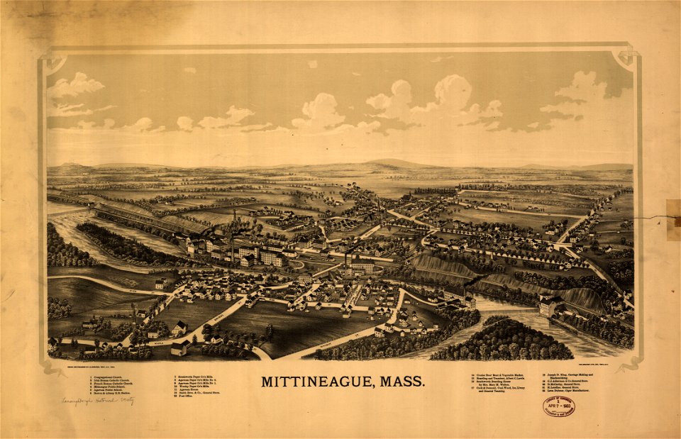
maps in the library of congress
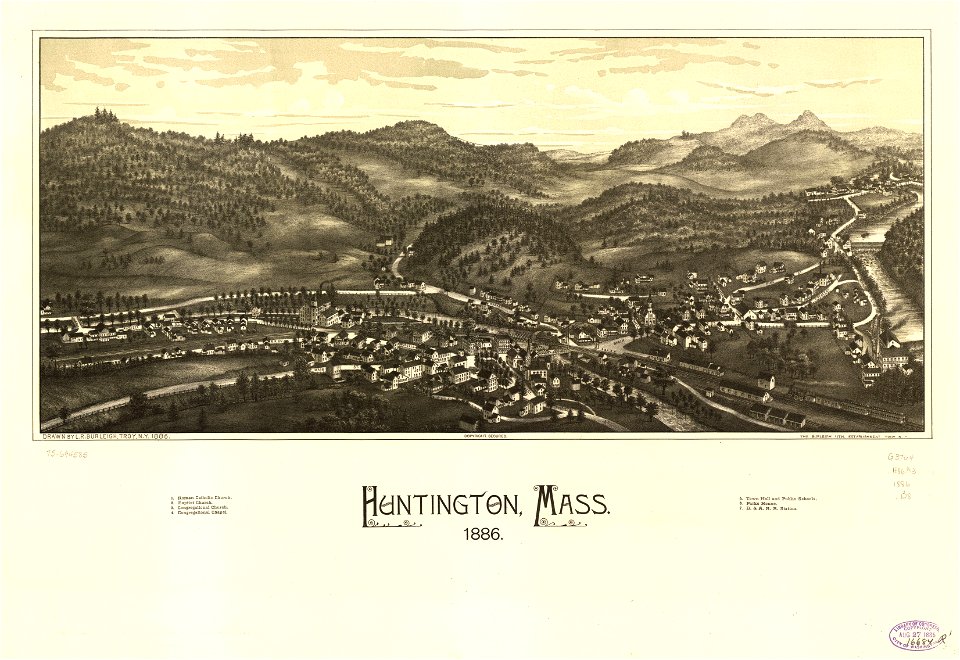
1886 maps of massachusetts
maps in the library of congress
1886 maps of massachusetts
maps of williamstown, massachusetts
maps in the library of congress
maps in the library of congress
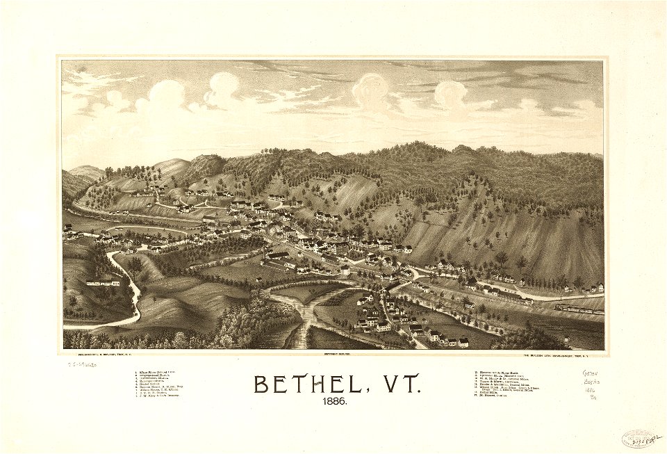
1886 maps of vermont
maps in the library of congress
old maps of new hampshire
maps from the earth and its inhabitants, vol. vii
charles eugène perron
images of places from encyclopædia britannica
old maps of edinburgh
maps by willem and johannes blaeu
17th-century images of algiers
prints of cartouches in the rijksmuseum amsterdam
maps in the rijksmuseum amsterdam
maps by willem and johannes blaeu
siege of groenlo 1627
images of places from encyclopædia britannica
1910s maps of london
images of places from encyclopædia britannica
1910s maps of london
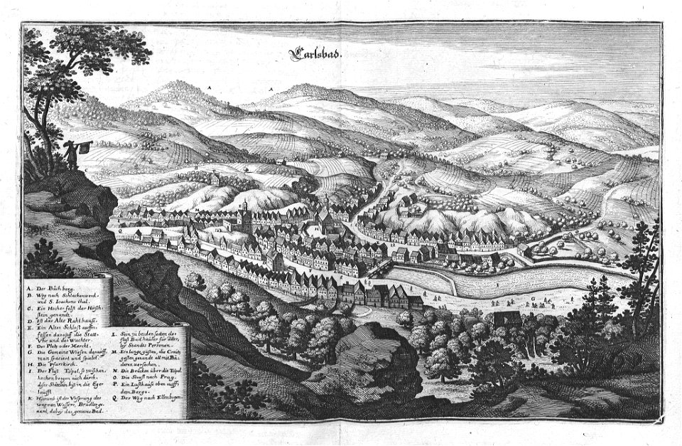
topographia braunschweig lüneburg (merian)
baroque
maps in the library of congress
1890 maps of new york (state)
foire saint-germain on old maps
baroque
maps in the library of congress
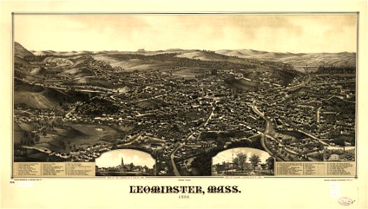
1887 maps of massachusetts
maps from the earth and its inhabitants, vol. vi
maps of the history of the caucasus
historical images of rapperswil-jona
topographischer atlas der schweiz
turgot map of paris – derivative files
old maps of île saint-louis
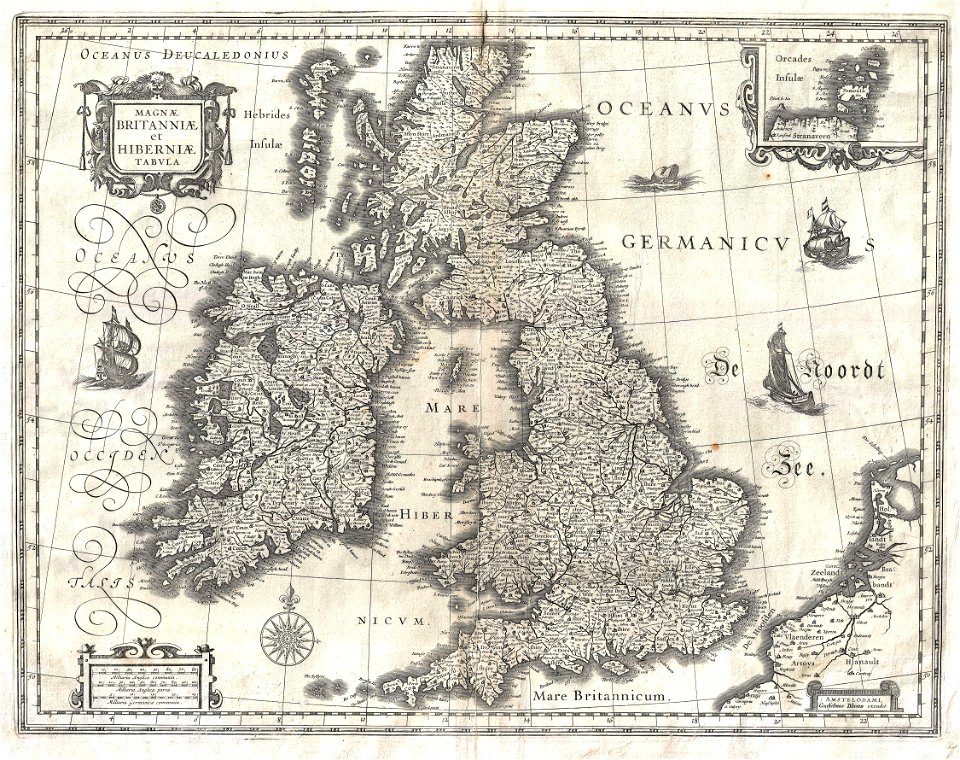
17th-century maps of the british isles
maps by willem and johannes blaeu
maps in the library of congress
1886 maps of massachusetts
bird's eye view maps of connecticut
maps in the library of congress
maps in the library of congress
1890 maps of new york (state)
maps in the library of congress
1886 maps of vermont
maps in the library of congress
1886 maps of massachusetts
maps in the library of congress
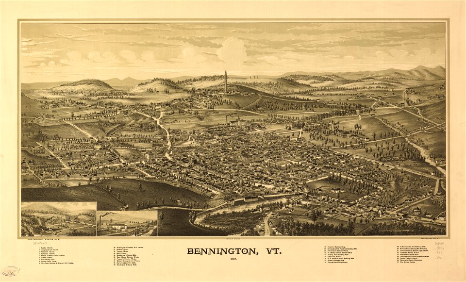
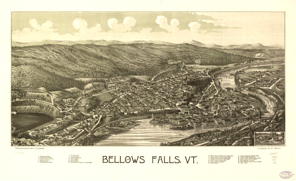
1887 maps of vermont
maps in the library of congress
1886 maps of massachusetts
maps in the library of congress
1720s maps of palestine
bird's eye view maps of illinois
maps in the library of congress
18th-century maps of ireland
old maps of dublin
old maps of douarnenez
old maps of brest
images of places from encyclopædia britannica
old maps of glasgow
images of places from encyclopædia britannica
emery walker
photos by viking 1 orbiter
lunae palus quadrangle
old maps of chania
1651 in chania
maps from the earth and its inhabitants, vol. vii
old maps of jiangsu
maps from the earth and its inhabitants, vol. vii
agricultural maps of china
historical images of the jardin du luxembourg
maps of jardin du luxembourg
maps in the library of congress
old maps of florida
map of paris by claes jansz. visscher - derivate files
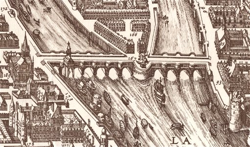
historical images of pont neuf
maps in the library of congress
old maps of new york (state)
atlas schoemaker-noord-holland, amsterdam
old maps of amsterdam
turgot map of paris – derivative files
ville l'évêque (paris)
maps in the library of congress
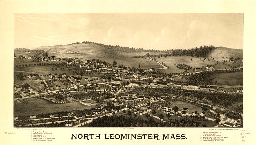
1889 maps of massachusetts
maps in the library of congress
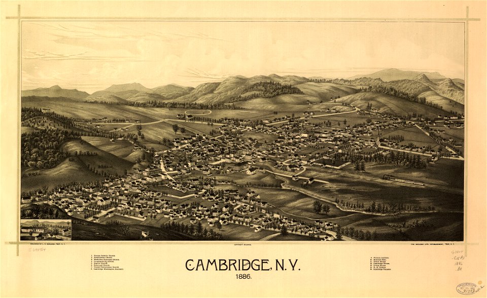
1889 maps of massachusetts
petit atlas pittoresque des 48 quartiers de la ville de paris, bhvp
proletarian literature
maps from the earth and its inhabitants, vol. ix
ethnographic maps of asia
curt teich postcard archives
map postcards
orbispictus - extracted images
1650s maps of the world
maps of municipalities in the district of dielsdorf
historical images of regensberg zh
lithographs of paris
floor plans of paris
la piazza di san marco in venezia, by quadri and moretti (1831)
19th-century maps of venice
maps in the library of congress
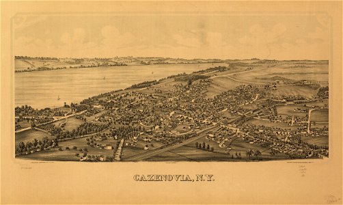
1886 maps of new york (state)
maps in the library of congress
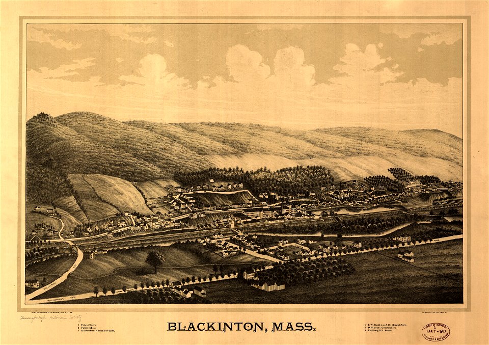
1887 maps of massachusetts
maps in the library of congress
1886 maps of vermont
maps in the library of congress
1886 maps of massachusetts
maps in the library of congress
old maps of yunnan
maps from the earth and its inhabitants, vol. x
maps with nicolosi globular projection
18th-century maps of catalonia
daniel de la feuille
maps in the library of congress
1769 maps of europe
description de l'universe
1680s maps of england
cornell's primary geography (1860)
1867 maps of africa
historical images of bolivia
potosí
maps in the library of congress
1882 maps of new york (state)
maps from géographie illustrée de la france et de ses colonies
orientalist painting
the comprehensive history of england (1876)
english-language maps showing history
zehn karten und ansichten den schlachtfelden des amerikanischen unabhängigkeitskreiges in den staaten pennsylvanien und new york
maps in the library of congress
cornell's primary geography (1860)
1867 maps of asia
curt teich postcard archives
map postcards
maps of impact craters on mars
maps of hellas quadrangle
1890s maps of the philippines
old maps of papua new guinea
petit atlas pittoresque des 48 quartiers de la ville de paris, david rumsey historical map collection
maps of paris from the david rumsey historical map collection
engravings of topographia bohemiae moraviae et silesiae
baroque
shober & carqueville lithographing company
maps in the library of congress
maps from the earth and its inhabitants, vol. ix
maps indicating exploration
maps from the earth and its inhabitants, vol. v
maps of railway lines in norway
palatinatus rheni (merian)
baroque
maps from traité de la police, bibliothèque nationale de france
first map of paris from traité de la police
maps in the library of congress
1886 maps of massachusetts
maps from the earth and its inhabitants, vol. xi
old maps of the sahara
maps in the library of congress
old maps of sichuan
maps of impact craters on mars
fontana (martian crater)
maps from the mechanical curator collection
1760
maps of the history of the united states
old maps of the british empire
maps in the british museum
1610s maps of ireland
maps in the library of congress
old maps of new jersey
description de l'universe
1680s maps of scotland
maps of edinburgh by braun & hogenberg
18th-century maps of scotland
maps in the library of congress
old maps of france
tinted lithographs in the british museum
victorian architecture
201 - 300 of 5,876
Next page
/ 59